myfishingcapecod
Nantucket Shoals and Georges Bank Fishing Spots
Nantucket Shoals and Georges Bank Fishing Spots
Couldn't load pickup availability
Members can use their MFCC Store Discount Code to get 25% off the retail cost of this chart! Please visit this page to retrieve your code.
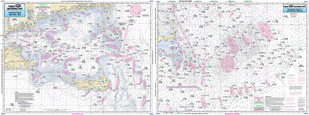
Captain Segull Sportfishing Charts highlight many of the best places to fish throughout Cape Cod & the Islands. These charts are extremely useful for finding good spots to catch striped bass, tuna, bluefish, albies, bonito, sea bass, fluke and more.
The front side of this chart details the waters 90 to 100 miles off the coast of Cape Cod & the Islands. Fishing spots are included from the area west of Nantucket, east to the Corsair Canyon and to the Canadian line, beginning with Veatch Canyon, and including the Winter Fishing Grounds.
The back of the chart details the nearshore waters off Nantucket and the Nantucket Shoals, west to the eastern half of Martha's Vineyard to 10 miles east of Nantucket.
All charts include GPS coordinates, wrecks, reefs, shoals, fishing areas, amenities and restrictions. Captain Segull Charts have been used for decades by mariners and fishermen on Cape Cod and they are an amazing value for the money!