myfishingcapecod
Fishing Spots Chart Bundle
Fishing Spots Chart Bundle
Couldn't load pickup availability
Members can use their MFCC Store Discount Code to get 25% off the already discounted price of this bundle! Please visit this page to retrieve your code.
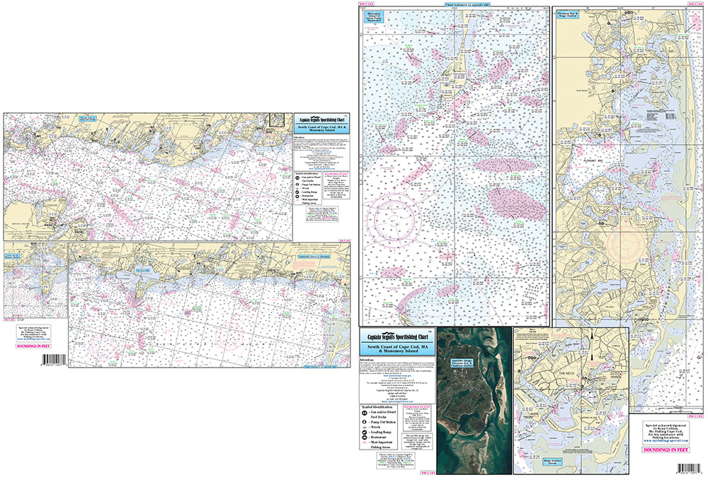
Get all 5 charts highlighting dozens upon dozens of fishing hot spots at the Cape Cod Canal, Buzzard's Bay, Cape Cod Bay, South Coast of Cape Cod Monomoy Island, Martha's Vineyard and Nantucket.
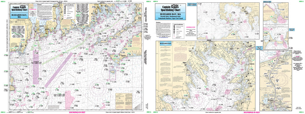
Chart #1 - Buzzard's Bay
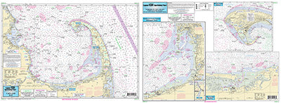
Chart #2 - Cape Cod Bay
Chart #3 - South Coast of Cape Cod & Monomoy Island
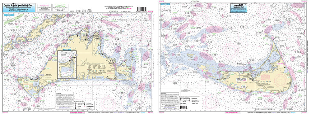
Chart #4 - Martha's Vineyard & Nantucket
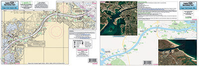
Chart #5 - Cape Cod Canal
Captain Segull’s Charts are designed for the serious sport fisherman. They show you fishing spots that will help you catch fish. All charts are laminated, waterproof and in full color. Average Large chart size is 19″ X 26″, Cape Cod Canal chart is 12″ x 18″.
Charts highlight: latitude and longitude (GPS), Loran lines, contour lines, shore services such as fuel docks, loading ramps, kayak launches, pump-out stations and restaurants. Also highlighted are fishing holes with local names, coordinates of buoys, inlets, reefs, rigs and wrecks.
If you want to know where to catch fish, get your ownCaptain Segull’s Sport Fishing Chart! These charts highlight more fishing locations than any app or GPS unit on the market.